Isles of Scilly! Day 3 Part 1: Bryher and Beyond!
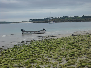
Up with the lark and ready to take the island adventure to the next level. Early boat to Bryher round the back of Samson and a landing at Rushy Bay due to the low tides, our first new experience came in climbing down from the big boat, into a smaller boat, and when that boat could go no further, climbing out and wading the last few metres ashore. I think Reepicheep said something similar about finding heaven in a well known TV series filmed partly in Scilly, so it's pretty fitting that we came ashore onto Bryher (12). Undeniably beautiful, but time was of the essence so we made a quick dash for it.
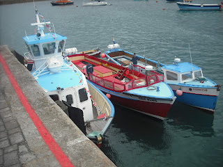 |
| Triple parked on St Mary's Quay |
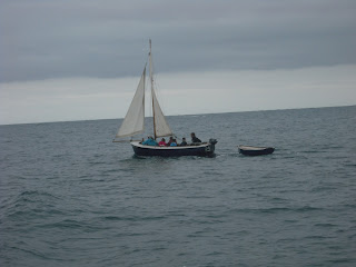 |
| Sailing Round Samson |
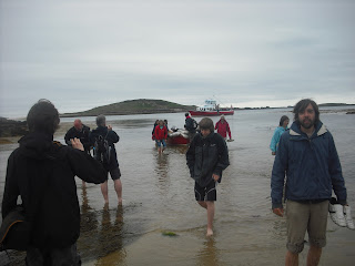 |
| Arrival on Bryher |
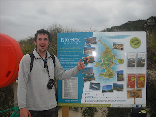 |
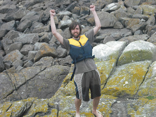
| No need for a caption. Me on Bryher |
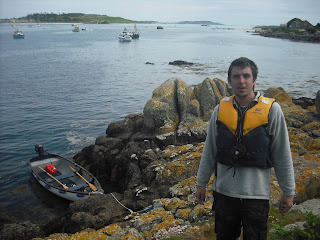
To what turned out to be quite the wrong place, Bennett's boatyard was almost right back where we'd come from. Eventually we got there and after signing some perfunctory paperwork and picking up some buoyancy aids, we were escorted out to the beach and down to our chariot for the day, a 14ft motorboat with a 4hp outboard motor. Now no island was out of our reach (as long as it was in the well defined "safe" area between Bryher, Tresco and St Martins)!
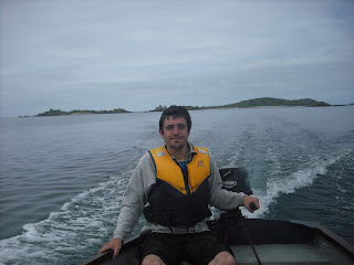
We had a map or two (and a dry one until Liam dropped it in the sea), and we knew that the tide was starting to come in, and with sausage rolls and out of date Rio we set sail aboard our good ship...For about a hundred yards, until we reached a giant sandbar blocking the exit between Bryher and Tresco, and unusually for a boat, we had to get out and push, even more unusually was meeting some other guys pushing their boat the other way. When in Rome I guess! With that over we got back on board and headed around the southern side of Tresco and towards St Martins, our first stop being the tiny Guther's Island (13) where we first practiced stopping the boat with accuracy. Didn't crash!
 |
| We have an awful lot of pictures exactly like this. Liam on Guther's Island |
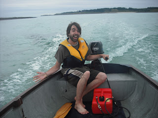 |
| First Mate Liam takes a turn at the helm |
Next we sped over to St Martin's (14) for our briefest stay on an inhabited island, just long enough to get onto dry land and take some snaps, partly because the tide was coming in and we couldn't leave the boat for too long, partly because we had so much to do, and partly because I heard the pub was closed anyway. Sorry St Martin's, next time...next time.
 |
| St Martin's |
Then it was a short hop across to Tean (16), without missing the tiny tidal outcrop of Crump Island (15) to the South. This was our first encounter with the screaming circling gulls, who seemed intent on keeping us away from their nests. Fair enough, it's their island, so we just stayed long enough to get a picture and basically ran away.
 |
| Tean. Real Life Angry Birds. |
After this came something of a scary moment. In fact, probably the scariest moment of the holiday, if not the year. You see, there is a good way to go from Tean to St Helen's. It's not very far and it's not very rough (and it's also within the area we were permitted to go). There's also a bad way to go, around the back of Tean, towards Round Island, where there is no cover at all from the Atlantic swells and only the jagged shoreline behind for refuge (or a complete obliteration). We went that way.
The waves were bigger than the boat and Liam who was steering at the time suddenly went very quiet, then very loud and many expletives came out of his mouth. All we could see ahead of us were rocks and more rocks, some of them clearly just under the surface, and we didn't really know the way. There was no time to check the map and certainly no time for pictures, as it took four eyes and a lot of swearing to remain in control. Eventually we came upon a small opening between Tean and St Helen's (17), perhaps fifty metres wide, and keeping as clear from the rocks as possible Liam managed to steer us back into calmer water. We disembarked and scrambled up onto the grass, rounded to the ruins of an isolation hospital where they used to put the sick sailors to stop them infecting other island folk (and probably usually to die) before again the gulls decided to take control, and yet again the tide was rushing in faster than our anchor dragged up the beach, so we high-tailed it back just in time as a sandbar was being washed away.
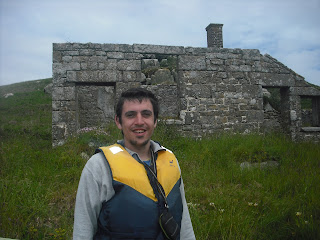 |
| Outside the ruined isolation hospital on St Helen's (and still alive!) |
 |
| Our Little Boat, either on St Helen's or Northwethel. Memory blurs |
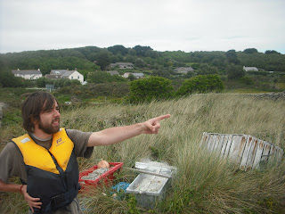
Next were a few little islands, Northwethel (18) came first, where we found some interesting stones that are either Neolithic or from when someone had a campfire recently. From there it was across to Foreman's Island (19) and a little wade across a seaweed covered slippery channel to Peahopper Island (20), we tried to land on Crow Island but the kelp was too thick to use the motor and the oars kept getting caught. It wasn't much more than a bit of rock anyway, so we decided against it.
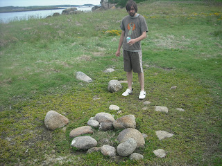 |
| A find of huge archaeological importance on Northwethel |
 |
Peahopper island from Foreman's island. Just about wadeable if you've already got wet up to
your waist twenty times today
|
After that, it was time for the long (not very long, couple of miles tops) trip right around Tresco to Samson, and the map said that we'd find a few more islands when we got there. After some excellent seamanship from myself (modest as ever) we rounded the rocks between St Mary's and Tresco as they were being covered by the tide, and avoiding a few rocky outcrops again just under the surface, beached gracefully onto the white sand of Samson (21) just as the sun came out. The largest and most recently inhabited of the uninhabited islands, we took a little longer to climb to the top of the north hill and took in probably one of the best panoramas in the whole archipelago, with views all around to where we'd been and where we were going. Saw a few cairns and ruins, lots of gulls, and went back to the boat.
 |
| Captain Sam |
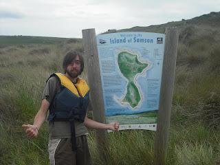 |
| Samson! Wahey! |
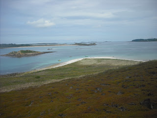 |
| From North Hill on Samson, St Mary's to the right, Tresco in the centre and left middle distance and Puffin Island to the left foreground. |
Next we made land on Puffin Island (22) next to Samson, I believe tidal, though the range is so wide it's hard to tell, and then with great difficulty, lots of rowing, punting and expert manoeuvring to reach the rocky weedy shoreline of Plumb Island (23). This one definitely is tidal, off the edge of Tresco, but we'd missed it the day before as the tide was out. Barely room to stand and take a picture (so my face was too big, so I'm not posting it) then we motored up between the pleasure craft in the bay between Tresco and Bryher to Hangman's Island (24), a steep rocky hill where a hangman's noose can still be seen on top where they killed loads of pirates in olden times.
 |
| Hangman's Island. The thumbs up pose was starting to wane |
After that it was time to head back to the boatyard and give back our new best friend. It's on my wish-list if anyone fancies buying me a nice new toy for Christmas? We had just enough time for a walk to the north of Bryher where we found the Fraggle Rock Cafe (pub), sunk one little pint of Rattler (couldn't drink and drive the boat) and then got back to the quay for the trip back to St Mary's. About six hours, thirteen islands, you'd think that would be enough fun for one day!
 |
| A nice picture of some boats |
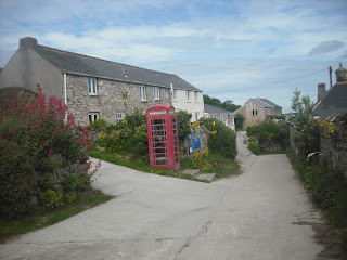 |
| Downtown Bryher |
 |
| Fraggle Rock Cafe. Blissful. |
 |
| Boat |


