Wednesday 29 August 2012

Shetland! Day 5: Itinerary Beakdown!

 So Papa Stour was off the cards, and so, after some signal searching and some unanswered calls and text messages, were Vaila and Linga near Walls. We were left with a day with no plan, no islands on the cards and no ferries to catch. Fortunately the house had a great big map, and we had heard a whisper that Shetland's largest uninhabited island was literally a stone's throw from the mainland. 

More on that later, first stop was a drive across from the west to the east, to Catfirth, in the parish of Nesting. Down a bumpy track past some traditional Shetland ponies (meaning an obligatory ten minute stop for Fran to make friends) we reached a stony gravelly causeway (tidal, we checked) leading across to the little island of Little Holm (15). It was fairly small, uninteresting and as usual we were under fire from the millions of terns, so we didn't stay long before heading back to the car. Being brutally honest it wasn't that good, but we've been there now, and it counts.


Little Holm across the causeway


Rubbish
 After this we spent a bit of time getting lost, ending up playing one of our favourite games driving to the end of every road. We ended up in Noonsborough and Clousta, tiny places so far away from anywhere that nothing is ever supposed to happen, and probably never does. The only real excitement was from the rudest named place in Britain. We definitely had to stop and take a picture of that.


Yep, that's right, I'm a Clousta
 After this we took the one road left to the north from Aith which led to Vementry. Vementry is a place, a farm and an island depending on what you want it to mean, where the road ends we parked up and went to see what we could see. The coastline around this part of Shetland is incredibly indented and whilst we knew that there were islands all around, it actually wasn't that easy to know what was an island and what wasn't, even with the map. We knew that we needed to rely on a bit of local knowledge, so we asked at the farm if there was any way we could get to the island. Interrupting the farmer from his whitewashing, he looked at us, then at his boat moored in the bay below, then back at us, and finally nodded. 

Vementry the place (Vementry the island in the background)
 "I can take you", he said, "if you give me ten minutes." One of our aims for Shetland had been to, as we put it, 'requisition' some private transportation for an island trip, and this looked like it was presenting the perfect opportunity. The boat was a little different to the ferries that we had been used to, a squat aluminium job with just about room for the four of us and the farmer. (We think his name was Hamish. Is that a Scottish stereotype? Did Angus tell us that? Did we make it up? If you read this, let us know, you're an official island baggers hero!) Anyway, safely aboard we literally sped across the channel at twenty eight knots, which is really really fast, and we were on Vementry (16) in no time. After jumping ashore and taking the obligatory silly photos we didn't stop for long so as not to keep the farmer waiting, but on the way back we explained to him a bit more about the mission and he had a bit of a suggestion. 

Durrrrrr

A bit windy perhaps
  Although Vementry was the biggest island in the area, one that he regularly crossed to ferrying sheep to and from their pastures, there were lots more that were reachable nearby if you had a boat and knew the way. Given an hour to properly finish his painting and a bit of cash to cover the fuel costs, he'd happily take us on a bit of a tour. If we said this was what we'd hoped for all along, it wouldn't be much of a lie, so we readily agreed and regrouped at the car. With an hour to kill, Mike and Fran were happy to wait by the car with a good book, but me and Liam had spotted a possible little treat down in the valley behind the farm.


Skipping down the hill, past overgrown stone walls and around the edge of the weed covered inlet as calm as a lake, we reached a beach opposite  a tiny little island, no more than ten or fifteen metres away, and it didn't look too deep. In another island baggers first, we stripped down to our underwear and waded out, but the dense weed made the progress a bit treacherous, we were worried we'd be stepping on crabs with every step. Still, we made it with no pinching incidents, and later learned it's name was Oggar Holm (17). 

Pants

Weed
 Meanwhile, back at the farm, the whitewashing finished, it was time for our second boat ride of the day, this time Hamish (?) had brought some wooden benches that slotted into the sides of the boat for extra comfort, and they definitely came in handy. Being fully on board with the island idea, he took us on a first rate tour of the islands in the bay, each time we thought one was the last he'd suddenly remember another little rock around the next corner. We didn't stop for long on any of them, but given that they were all uninhabited and mostly little windswept rocks, I don't think we missed much. First we went to the Holms of Uyea-sound (18). Apparently Hamish (just gonna go with it now, for consistency) had only ever been asked to take one person there before, and he was a guy who wanted to walk the coastline of all of the islands of Shetland. After a bit of a scout round the darkest corners of the internet, I reckon it was Walter Scott, pretty geeky, but definitely a hero!
On the boat
The Holms of Uyea-Sound I think
  After this was Papa Little (19), the little brother of Papa Stour, then on to a different Linga (20) in the end of St Magnus' Bay which reaches up to Brae. Even Hamish had never been here before, so I don't really know who ever would. From here it was back to little Inga's Holm (21) and then back to the west of Vementry, past the narrow channel that had it not been for Hamish we might have considered swimming, and through to Grink(Grinch?) Holm (22). Unremarkable.

Mike. Looks like an Eskimo in every picture (Inuit?)
"You can't go all the way to Scotland and not have one good picture"
Finally, the tiny, tiny little skerry right at the edge of the bay where the farm at Vementry sits. We're pretty anal when it comes to a description of an island, and one of the stipulations is that the landmass can support a couple of sheep. No problem said Hamish, I'll pop a couple over, then it'll definitely count. Does it have a name, we asked? Not as far as he knew, and he'd definitely be the one to know, so from now on, we're pleased to announce it is called "Bagger's Island"(23). No-one ever goes there, but in case you want to, our little island is here.


Bagger's Island (Vementry)
 So what started out as a day with no agenda at all turned out to be an awesome island hopping adventure. Nine in a day, a record for Shetland, and pretty good going under any circumstances. After all this exhilaration we headed to our bed for the night at Skeld, back out on to the west, a cosy little bod which we shared with a father and son team in Shetland to dive, but we think we had just as much fun on top of the water than under it. We were very careful that night to make sure the plans for tomorrow were all on track. After one little blip that turned into a great big adventure, it was almost (though not quite) a disappointment to know that everything was on course for our last full day in the islands.

Sunday 26 August 2012

Shetland! Day 4: Foula

 Day four began with an early start, a quick spruce up of the spartan accommodation at Nesbister, and a short drive around to Tingwall airport, just outside of Lerwick. Our places were booked for the fifteen minute flight to Foula on one of the the tiny 8 seater islander planes that service the remotest outposts of the remote archipelago, but immediately the trip was put in jeopardy when the lady operative advised that there had been a bad weather warning radioed in and unless things cleared up in the next forty minutes or so the flight would be cancelled. After some frantic researching of alternative methods of getting to Foula, and the possibility of a three and a half hour ferry instead of a plane, the call finally came through, the weather had cleared and we were all set to depart.

Being not the world's most confident air passenger it wasn't exactly reassuring to know the weather had just crossed into the acceptable side of bad to allow us to leave, but there was no going back as the same lady operative weighed our bags and even strapped us in to the aeroplane seats. Before we knew it we were up in the air, and seemingly before we knew it again we had touched down on the tiny gravel airstrip on Foula, with a white-knuckle moment as it simply looked like the plane wouldn't stop and we'd be thrown over the cliff into the sea. The pilot, however, was clearly experienced in this game, and he gracefully turned the plane around and taxied back to the "terminal". 
 
The sheer unadulterated jubilation of solid ground beneath your feet


That building behind the sign is the airport. All of it.


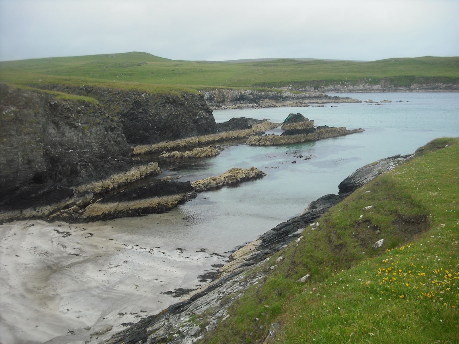
 Foula is an island that needs a little bit of explanation. Often described in guidebooks as Britain's most remote populated island (though I've never understood what makes it more remote than Fair Isle), it has a population of just over thirty, no proper harbour (the boats have to be winched out of the water), no shop and only one road.  A large proportion of the landmass is taken up by a range of cloud covered mountains, reaching back to huge sea cliffs on the western coast, leaving only a narrow corridor of flat, fertile land to the eastern edge. 

What it does have is a tiny five-pupil primary school, the aforementioned airstrip providing a vital lifeline to the mainland, and a smattering of ramshackle first, second and third generation homesteads and lots and lots of sheep. Anecdotal evidence from around the other islands had told us that the people of Foula were both very intelligent and also very lazy. I suppose that this is the sort of appraisal you could make from seeing the cars, machines and building materials simply lying around rusting, but when you consider the prohibitive cost of moving anything you can sort of understand.


Digger Graveyard


After arrival we had considered scaling some of the ominous hills to the west, with ominous Nordic names like Da Noup, Da Sneug and Hamnafield, or even heading all the way to the edge of the world at Da Kame, where the sea cliffs are the second highest in the British Isles, but we could literally see the driving rain up on top, and travelling light with no change of clothes we opted instead to trek up the road to the northern tip and back.


 We began by taking in a coastal walk to a war memorial commemorating the men of Foula who died in the two world wars. It's sobering to think that an island of such small population could still send men away to fight, with the devastating effect that their loss would have on the survival of those they left behind.


War memorial

A well earned rest

Looping back around we came down into Ham, one of the two areas of Foula which have been described as a settlement, though the straggle of houses here seems no more dense or organised than much of the rest of the road. There's a post office which was closed, a small valley with a beautiful walled garden, a real shock in such a desolate place, and the narrow entrance to the harbour filled with seals, who looked remarkably tame as they surfaced to say hello.


From Ham the road leads further north and we followed, past the modern primary school built for just five pupils, and winding over undulating fields full of sheep and enormous areas of cut peat. Expertly sliced from the ground and stacked neatly to dry out in the wind the peat is a good literal example of the strong relationship with and reliance on the land that the people of Foula and indeed Shetland share. With transportation costs so high it's hard to imagine this fuel being removed from Foula, so one imagines that it is very much a community industry.


Following the map we reached the end of the road past houses called Da Loch and Da Burns, simple crofts that stand isolated amongst the fields and in the shadows of the mighty peaks to the west. At the end of the road there is an incline over a ridge which slopes down to the sea. Natural arches and sea birds abound, a perfect place for a picnic. 


Another feature of Foula that puzzled us for some time about Foula were the methods of transportation. The old cars that ferry sheep, dogs and peat up and down the main strip are mostly decrepit and falling apart, bumpers missing and clearly being run literally into the ground. We later learned that these were 'isles cars' - whilst those on the mainland of Shetland require the usual annual MOT tests, when they fail instead of being scrapped they are transported to the smaller islands of Foula, Out Skerries, Unst and Fetlar. They can be driven here without an MOT certificate until they stop working, and when they do stop working they can be transformed into a convenient shed for storing fleeces or tools.


After working our way back down to the airfield we still had an hour or two until the flight, so after leaving Mike behind to nurse an injured ankle from new boots, me Liam and Fran headed to the south end and the second settlement of Hametoun. Settlement seemed an even less suitable name for this place, the three or four houses only slightly closer together than those on the rest of the island. There were however several people around, and building work going on that did give a brief feel of activity to the island. Past the last of the houses we reached the dramatic cliffs with views out over the expansive and restless sea to the south. To look out over the endless waves crashing against the island from miles around really brings home the remoteness and wild nature of the place.


Eventually the time did come to head back, but we were in for one final surprise before we left. Two young girls that we had seen tending to sheep earlier on arrived in a battered old car, and headed in to the tiny island's fire station. After a few minutes they came roaring out of the entrance in an antiquated fire truck, having donned full fireman's uniforms, if a little ill-fitting. They appeared to genuinely relish the vital task of speeding across the runway, sirens blaring and arms waving to scare away the three or four sheep that had strayed onto the gravel during the long part of the day when the airport lay quiet. Obstacles successfully removed, we soon heard, and then saw the little plane coming over the sea through the clouds. Moments later it was down, discharging its cargo of four or five people and lots of boxes, and moments later again we were strapped in and pootling along before sweeping up into the sky, bouncing back to Tingwall.


Our bed for the night was in the bod at Walls, on the western side of the mainland, where we had the run of a great big old house with what must have been twenty beds. Rather than make use of the well appointed kitchen, however, we decided to treat ourselves and drove to Brae up the winding road via Bixter and Aith, where we indulged in some delicious and filling fish and chips. Back at the house, there was a sharp intake of breath when we checked the itinerary and cross-referenced with the ferry times. Tomorrow was Thursday, we were supposed to be going to Papa Stour, but no ferries go to Papa Stour for a Thursday day-trip. How had we got it so wrong?! A chance meeting with a couple of the neighbours led to an enlightening hour or two hearing the histories of the islands in the bay in front of us. Little Linga, and larger Vaila, populated and housing its own castle. Would a visit be possible? There were no ferries but armed with the telephone numbers of the owner and her boatman, we had a lead to follow up in the morning!


Thursday 2 August 2012

Shetland! Day 3: The Scalloway Isles and Kayaking Ronas Voe

Maybe it was the good meal, the good bed, or perhaps the good cider, but we definitely didn't get up in line with the strict itinerary on day three. Eventually and with the help of some pancakes from the bakery across the road, we made it out of Voe at about eleven, heading for Shetland's ancient capital of Scalloway, on the west coast, with a population of under 1,000. After browsing the bookshop/cashpoint we moved on to Scalloway's own little archipelago, islands all connected by road forming a finger down into the water.

Scalloway in the sunshine
The first of these was Trondra (8). Very little to report, we only really got out of the car to take pictures in front of the sign. There's probably lots of interesting stuff to say about Trondra, I just don't know what it is. Driving across the next bridge we came to West Burra (9) and a third bridge to East Burra (10) at the end. Here we indulged in some good fun island bagging, a few little tiny tidal dinkers that required more fence hopping and a bit of clambering to reach. The first, off Smiddy point at Houss (10) required us to tightrope walk or shimmy across a piece of discarded marine architecture, some pipe or other which had washed up and formed a handy bridge over the narrow channel. 

The bridge to Trondra seen from Trondra
Super-Cool
Liam and the Doctor on East Burra
A lot of discussion has gone into the definition of exactly what defines an island. Can it support two sheep? Does it have a variety of vegetation? Does it matter if it's cut off every high tide or only a couple of times a year? All important questions to ask, but never has it been does a metal pipe bridge prevent it becoming an island. Definitely not, we're counting it!


Definitely an island

The next two were right across the bay, jutting out from what the most detailed map we could find referred to as "the taing", though there are lots of 'taing's all over Shetland, so maybe that's a generic term. Anyway, to be specific the inner one is at 60.064839 / -1.317957 and the outer one is just further out (11 &12). We started our walk across the sandy gaps as four but soon reduced to two, Fran and Mike genuinely unprepared to risk death from above from the angry terns who this time were actually attacking. Me and Liam dashed for it and managed to climb onto both of the little islands and get evidential picutres and sprint back before we got smashed to smithereens.


Death from above?


Shetland's biggest export. Pony.


 Next we ventured back to West Burra and down to Kettla Ness, a large headland connected by a tombolo, but again not an island, but with the sun shining incredibly picturesque. A couple of ruined buildings and hundreds upon hundreds of sheep.


 After this our original intention had been to meet up with Angus from Sea kayak Shetland to head out to some of the non-connected islands in the bay from Hamnavoe on West Burra, but he said the seas were still too rough after a force seven storm a few days before (see Bressay), but if we wanted we could join him at Ronas Voe back in Northmavine. It would mean no extra islands today, but still sounded like great fun, so we hot-footed it to Heylor and met first Angus's friend Phil, then the man himself arrived with enough kayaks for all of us. 

Nice skirt
After donning protective gear and a quick lesson in kayak steering, we were out on the quiet water deep in the Voe, with the edge of Shetland's highest peak, Ronas Hill, rising up out of the water on the opposite bank. Angus took us through some interesting and at times hair-raising rock formations, pointing out the wildlife and giving us insights into the geography and geology of the area.


Kayaks
Hair-Raising Rock Formations
With seals swimming around and under the boats and puffins (tammy nories) bobbing on the water next to us it was pretty magical. After about two and a half hours and about three or four kilometres we rounded a sea-stack and made back for the beach, Mike winning the obligatory race by miles.  


Liam and the Doctor
In a little cave

  At about eight we finished on the water and drove first to Brae for supplies at the Co-op, then on to Nesbister for our most isolated accommodation yet. Situated on the end of a shingle spit, the böd, an old fishing hut, had no electricity, no shower and only a chemical toilet out the back. Arriving as it was already getting dark didn't help much, but after lighting a few candles and getting a peat fire going we got a little bit more comfortable and Fran was able to cook us a delicious dinner of pasta, ham, green beans and woodlice on the single stove. With no light to see by and exhausted from a day of physical activity, we were soon to bed and thoughts on the adventure tomorrow.


'Kitchen' at Nesbister


Shetland! Day 2: Fetlar, Mainland, Muckle Roe, Whalsay

After a decent night's sleep and and a spot of breakfast we set off for an early morning explore of Fetlar. There's only really one road, and as we'd arrived from one end, we decided to check out the other. First place we came to was Funzie (disappointingly pronounced 'Finnie' apparently), not really worthy of a place name, but at the end was a shingle beach with the 'Haa of Funzie standing above, from where Shetland fisherman in the nineteenth century set out in their open topped sixareens to fish the waters up to fifty miles out to sea in treacherous conditions. Not stopping for long we went right to the end of the road,  parked the car and continued on foot around some impressive cliffs with turquoise sea below. 

We made a brief stop to cross on a narrow isthmus to a piece of land almost cut off from the rest of the island, we figured one day it'll probably erode itself away into an island, then when it does we can say we've been there already. Counts right? On up the hill we came to our intended destination, the round house at Gruting (which is definitely not a place. It has one building and that has fallen down). 

The roundhouse was built by Sir Arthur Nicholson, classic Shetland baddie, who bought most of Fetlar in the past sometime and told all the crofters they had to leave his land. He used the stones from their dismantled and demolished crofts at Gruting to build his own 'single storey classic summerhouse' on the loneliest spot on the island. Rumour has it that he only stayed one night, because he heard strange noises and was too unsettled to stay any longer. Was it the ghosts of the displaced farmers showing their displeasure? Probably not, but it was a good background story for a bracing walk up through the Fetlar countryside.


The beach at Funzie


The sea looked more Scilly than Shetland here


The beach at Gruting


What's left of the roundhouse at Gruting

Back to the car and straight back to the ferry at Hamar's Ness we again crossed Yell doublequick and on to the mainland. The itinerary had a few hours free before our next ferry crossing, so we decided to see what extra islands we could fit in. The first of these was big enough and populated enough that we really should have had it in our sights before, but it was good that we had some time to explore Muckle Roe (6) either way. To get there you go west from what looked like Shetland's most happening town outside of Lerwick, Brae, but you don't carry around the road towards Northmavine, it's probably pretty easy to miss. Joined to the mainland by a little bridge it's a pretty uniformly round island (used to be a volcano) and home to around a hundred people who don't have to rely on a ferry to get anywhere unlike most of the people on the other islands. 

After stopping for the obligatory thumbs up pictures we did our usual thing and carried on to the end of the only road, which turns into a track, which turns into a footpath, and eventually you come to yet another rugged and beautiful beach, this time we had what looked like some kayaking scouts for company, well their tents and their kayaks at least, no-one to be seen. This seemed like as good a location as any to host the inaugural Shetland All-Britain Rock Boules Cup, with me representing Wales, Mike was England, Liam tenuously Ireland as his Dad's Dad is from there, and Fran even more tenuously Scotland as that's where she went to medical school. Despite difficult weather conditions the first two rounds saw Wales and England qualify for the final, with Wales taking the eventual crown. Just a little bit of competitive sport to make up for us missing the start of the olympics!


The sign actually relates to the bridge, they neither widened nor strengthened the island
Fishing Boat
Action shot from the sporting action
On the beach on Muckle Roe


 Having consulted lots of maps for possible islands we could visit without the use of a boat in between trips, we had seen Gluss-Isle and thought we'd give it a go. Heading for the first time across the narrow isthmus of Mavis Grind and into Northmavine we drove towards Ollaberry and down a tiny farm track to Gluss, where a causeway stretched across the water to the 'island'. Braving Arctic Terns overhead and scaring away the resident sheep we crossed the ayre on to the landmass, but we were far from sure it counted as a proper island. Knowing that the tidal range in Shetland is very low, only about a metre and a half, the causeway seemed to dry and established to ever be covered by the sea. After some tentative photos we returned to the car, and in one of Shetland's rare and seemingly random 3g reception areas confirmed via smartphone that no, Gluss-Isle, despite the name, is really just a glorified peninsula.


The causeway to Gluss
Is it a bird, is it a plane? It definitely isn't an island!


 Moving on, to what definitely does count as an island we drove across the mainland to Laxo for the four o'clock ferry to Whalsay (7). In the main the ferries around Shetland are quick, cheap and hassle free to use, presumably heavily subsidised as they are a vital lifeline to the residents. The boat to Whalsay was no exception, and we left the car at Laxo to cross as foot passengers for the half hour ride.

For its size and distance from the mainland Whalsay felt positively bustling with activity during the three hours or so we spent there, with Symbister, home of a large part of the Shetland fishing fleet genuinely managing to feel like somewhere with something going on. Boasting its own leisure centre, well appointed school, actual proper shops and Britain's most northerly golf course, it was one of the few islands I could imagine people actually living their lives on. 

After a stop to explore the Hanseatic trade museum in the authentic booth right out on the harbourside (entrance a pound, get the keys in the shop across the road) we headed up into the hills for a good ramble, vaulting a couple of fences and dodging an angry looking bull to get out on the open moorland. After a bracing couple of miles and an awful game of throw the rock at the rock, we collected lots of shells for fun and then returned to Symbister and waited for the ferry back 'home'.


If the Whalsay tourist board is looking for a new poster boy...


Emblem outside the museum


Boggy


Boats in the harbour at Symbister
 Home that night was at the Sail-Loft camping böd in Lower Voe, a great big space with room for sixteen, but we had it to ourselves. Overlooking the little pier behind, and conveniently opposite the only pub we ventured into in Shetland, the Pierhead restaurant and bar, where we splashed out on moules et frites, presumably caught fresh that day from one of the many mussel farms in the voe. A relaxing end to what was a fairly relaxing day island count wise, only two new ones, though we'd hoped it might have been three, still lots more days to go!


The view from the window at the Sail Loft