Tuesday, 12 June 2012

Isles of Scilly! Day 3 Part 2 and Day 4: St Mary's

Gluttons for punishment that we are, we arrived back to St Mary's tired and damp at around half five, but rather than relaxing and taking it easy on our last night, after some chips from the best organised chip van ever (with 2 Brian's), we decided to do a quick lap of the island, hoping to get round to the Old Town Inn, the last of the Scilly pubs (that we knew of) in time for a quick drink before bed. 

Things started well enough, we followed some inland tracks and paths (as we'd already done the first part of the coast path on day one) until we came to Halangy Down and some old-timey neolithic rock formations at Bant's Carn and the Iron Age village. The sun was shining and there were awesome views out over the islands in the late afternoon. 

Scilly, but no sea view. A real rarity. 

Bant's Carn, Halangy Down. Real old burial chamber.

That little bit or rock in the foreground is Creeb. We thought it might have been a proper island, but it's pretty Creeby. 

After hiking around some idyllic coast path, with the scenery changing at every promontory, and eventually the distant and unreachable Eastern Isles coming into view, we saw below us the rocky crag of Innisidgen (25) like a finger pointing away from the land. It had it's own burial mound, but most of all it was a tidal island, and yet again we had arrived just as the tide was receding to form a causeway over the rocks. Old hands at this sort of game now we sat and waited for perhaps ten minutes before a splish-splash jump and skip onto the rocky little island. Didn't stop for long, took a photo and carried on.


Innisidgen Burial Chamber


Innisidgen from the shore, as the tide washed out


Made it!
From there we knew there was one more island left to do, Toll's Island, a sizeable tidal affair in the centre of Eastern St Mary's. When we arrived the causeway was sandy, so wading seemed like a reasonable option, but it was just too deep for a bit, so we indulged in a game of our new favourite Scilly sport, Rock-Boules. Pretty straightforward, chuck stones at other stones. Hit the middle stone and score points, less points in the outer rings. All you need is some stones.


Rock-Boules. I think I was probably winning. 
Unfortunately while we were waiting, the tide was definitely going out, but we were in fact getting a lot wetter. The rain had started, and with it the realisation that we were a good couple of miles from the tent (and possibly anywhere dry). This was compounded by my foolish and regrettable decision to leave my jeans on and not change into my shorts when it was time to wade across to Toll's Island (26), as it was deeper than I thought, I got soaked, and had to put up with carrying a soaking pair of jeans for the next four miles, and wearing my shorts in the pouring rain didn't keep me warm at all. A slightly miserable and uncomfortable end to the islands of Scilly, but I still managed a half-smile for the required evidential picture!


OK maybe a bit fed up now!


Toll's Island from the shore. In the rain. 
The rest of the way around to Old-Town was fairly miserable, it was getting dark, raining heavier all the time, and apart from a cave where we took shelter for ten minutes, we kept getting wetter and wetter. Notable things about this part of St Mary's - rock shaped like a camel, monument to the person with the best name ever, Admiral Sir Cloudesley Shovell, whose ship was dashed against the rocks in 1707. Also it was fun to walk right up close to the runway of the airport, not many can have footpaths so close. There was probably more stuff that would have been good to look at, but we were in a "head down, keep going" mode, all the way to the somewhat posh Old Town Inn. Couple of pints in almost silence from exhaustion, then a sodden trek up the hill to Hugh Town and bed.


Rock Like a Camel


Monument to Cloudesley Shovell
Next morning we had to be off the campsite by eleven, and whilst we had entertained the idea of getting a quick trip out to land on one or more of the Eastern Isles, we never did. Partly maybe the jubilee celebrations meant there were less boats running, but we were pretty much whacked from the day before to make too many strenuous enquiries. We watched the boats come and go for an hour or so, had one last game of Rock-Boules on Porthcressa beach, and caught the 4:30 Scillonian back to Penzance. 

Time for one more island? Definitely time for a look, but at eight when we drove round to Marazion there was still an awful lot of water between the shore and St Michael's Mount, and we still had a 200 mile drive in front of us and I had work the next day. Another time, another time...


St Mary's Quay, Queens Jubilee Day 2012


Loading the Scillonian for departure.


We'll get you one day!
So yeah, that was our four days in Scilly. I think we packed about as much in as we could, but we didn't go to Annet, or Gweal, or any of the Eastern Isles, so there's definitely enough to warrant a return visit one day. We had an awesome time thanks, just back to work for a month and a bit then off to Shetland for the week!

Monday, 11 June 2012

 Isles of Scilly! Day 3 Part 1: Bryher and Beyond!

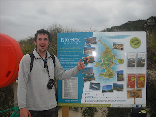
Up with the lark and ready to take the island adventure to the next level. Early boat to Bryher round the back of Samson and a landing at Rushy Bay due to the low tides, our first new experience came in climbing down from the big boat, into a smaller boat, and when that boat could go no further, climbing out and wading the last few metres ashore. I think Reepicheep said something similar about finding heaven in a well known TV series filmed partly in Scilly, so it's pretty fitting that we came ashore onto Bryher (12). Undeniably beautiful, but time was of the essence so we made a quick dash for it. 

Triple parked on St Mary's Quay

Sailing Round Samson

Arrival on Bryher

No need for a caption. Me on Bryher

To what turned out to be quite the wrong place, Bennett's boatyard was almost right back where we'd come from. Eventually we got there and after signing some perfunctory paperwork and picking up some buoyancy aids, we were escorted out to the beach and down to our chariot for the day, a 14ft motorboat with a 4hp outboard motor. Now no island was out of our reach (as long as it was in the well defined "safe" area between Bryher, Tresco and St Martins)!

We had a map or two (and a dry one until Liam dropped it in the sea), and we knew that the tide was starting to come in, and with sausage rolls and out of date Rio we set sail aboard our good ship...For about a hundred yards, until we reached a giant sandbar blocking the exit between Bryher and Tresco, and unusually for a boat, we had to get out and push, even more unusually was meeting some other guys pushing their boat the other way. When in Rome I guess! With that over we got back on board and headed around the southern side of Tresco and towards St Martins, our first stop being the tiny Guther's Island (13) where we first practiced stopping the boat with accuracy. Didn't crash!

We have an awful lot of pictures exactly like this. Liam on Guther's Island

First Mate Liam takes a turn at the helm
Next we sped over to St Martin's (14) for our briefest stay on an inhabited island, just long enough to get onto dry land and take some snaps, partly because the tide was coming in and we couldn't leave the boat for too long, partly because we had so much to do, and partly because I heard the pub was closed anyway. Sorry St Martin's, next time...next time.

St Martin's
Then it was a short hop across to Tean (16), without missing the tiny tidal outcrop of Crump Island (15) to the South. This was our first encounter with the screaming circling gulls, who seemed intent on keeping us away from their nests. Fair enough, it's their island, so we just stayed long enough to get a picture and basically ran away.

Tean. Real Life Angry Birds. 

After this came something of a scary moment. In fact, probably the scariest moment of the holiday, if not the year. You see, there is a good way to go from Tean to St Helen's. It's not very far and it's not very rough (and it's also within the area we were permitted to go). There's also a bad way to go, around the back of Tean, towards Round Island, where there is no cover at all from the Atlantic swells and only the jagged shoreline behind for refuge (or a complete obliteration). We went that way. 

The waves were bigger than the boat and Liam who was steering at the time suddenly went very quiet, then very loud and many expletives came out of his mouth. All we could see ahead of us were rocks and more rocks, some of them clearly just under the surface, and we didn't really know the way. There was no time to check the map and certainly no time for pictures, as it took four eyes and a lot of swearing to remain in control. Eventually we came upon a small opening between Tean and St Helen's (17), perhaps fifty metres wide, and keeping as clear from the rocks as possible Liam managed to steer us back into calmer water. We disembarked and scrambled up onto the grass, rounded to the ruins of an isolation hospital where they used to put the sick sailors to stop them infecting other island folk (and probably usually to die) before again the gulls decided to take control, and yet again the tide was rushing in faster than our anchor dragged up the beach, so we high-tailed it back just in time as a sandbar was being washed away. 
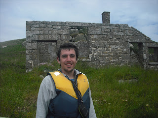
Outside the ruined isolation hospital on St Helen's (and still alive!)

Our Little Boat, either on St Helen's or Northwethel. Memory blurs
Next were a few little islands, Northwethel (18) came first, where we found some interesting stones that are either Neolithic or from when someone had a campfire recently. From there it was across to Foreman's Island (19) and a little wade across a seaweed covered slippery channel to Peahopper Island (20), we tried to land on Crow Island but the kelp was too thick to use the motor and the oars kept getting caught. It wasn't much more than a bit of rock anyway, so we decided against it.

A find of huge archaeological importance on Northwethel

Peahopper island from Foreman's island. Just about wadeable if you've already got wet up to
your waist twenty times today


After that, it was time for the long (not very long, couple of miles tops) trip right around Tresco to Samson, and the map said that we'd find a few more islands when we got there. After some excellent seamanship from myself (modest as ever) we rounded the rocks between St Mary's and Tresco as they were being covered by the tide, and avoiding a few rocky outcrops again just under the surface, beached gracefully onto the white sand of Samson (21) just as the sun came out. The largest and most recently inhabited of the uninhabited islands, we took a little longer to climb to the top of the north hill and took in probably one of the best panoramas in the whole archipelago, with views all around to where we'd been and where we were going. Saw a few cairns and ruins, lots of gulls, and went back to the boat.
Captain Sam
Samson! Wahey!
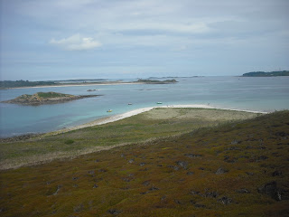
From North Hill on Samson, St Mary's to the right, Tresco in the centre and left middle distance and Puffin Island to the left foreground. 

Next we made land on Puffin Island (22) next to Samson, I believe tidal, though the range is so wide it's hard to tell, and then with great difficulty, lots of rowing, punting and expert manoeuvring to reach the rocky weedy shoreline of Plumb Island (23). This one definitely is tidal, off the edge of Tresco, but we'd missed it the day before as the tide was out. Barely room to stand and take a picture (so my face was too big, so I'm not posting it) then we motored up between the pleasure craft in the bay between Tresco and Bryher to Hangman's Island (24), a steep rocky hill where a hangman's noose can still be seen on top where they killed loads of pirates in olden times.

Hangman's Island. The thumbs up pose was starting to wane

After that it was time to head back to the boatyard and give back our new best friend. It's on my wish-list if anyone fancies buying me a nice new toy for Christmas? We had just enough time for a walk to the north of Bryher where we found the Fraggle Rock Cafe (pub), sunk one little pint of Rattler (couldn't drink and drive the boat) and then got back to the quay for the trip back to St Mary's. About six hours, thirteen islands, you'd think that would be enough fun for one day!

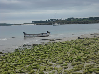
A nice picture of some boats

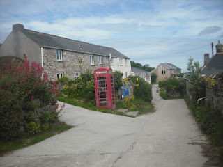
Downtown Bryher

Fraggle Rock Cafe. Blissful. 

Boat

Thursday, 7 June 2012

Isles of Scilly! Day 2: Tresco

So after a not particularly comfortable nights sleep, we woke at about three, four, five, six and seven to a flappy windy tent and faintly damp clothes. After wasting time with croissants from the campsite shop for breakfast it was time for a phone call. Bad news, our adventure planned for today would have to wait until tomorrow, the weather was simply too rough. So with a brief change of plans we decided that we'd take it easy, get a boat over to Tresco (10) and see what we could see. 

Arriving at the Carn Near slipway as the tides were too low for the quay at New Grimsby, we found ourselves at one end of a beach which seemed to disappear around the low lying headland to the east, the weather wasn't perfect, breezy and drizzling, but it seemed as good a way to go as any. 

Liam on the beach on Tresco
On the seaward side of the beach were many rocky outcrops, but having consulted the map it was clear that only one of them had proper land and vegetation and could therefore rightly be called an island. On the far south eastern corner of Tresco we clambered over the rocks and made an ascent of Green Island (11).

Green Island, Tresco. Various rocks in the background, with the south hill of Samson on the right

We then carried on around the beach into the calmer waters between Tresco and St Martins, something of an island playground, with sizeable islands literally scattered around the northern end.


From the beach on Tresco
 After a while we rounded another bay and the village of Old Grimsby came into sight, though in reality and from close up it is neither old, nor a village. It seems predominated by a large holiday timeshare complex, and very nice too, if you like that sort of thing. Heated pool, large apartments, sun loungers overlooking the beach, but not quite rugged enough for somewhere so remote. Beyond the complex and through a gate the path took us somewhere quite the opposite.


""Old" Old Grimsby". Most of the new apartments were further to the right
The northern part of Tresco felt more like I'd expected of an island renowned as a pirate stronghold and a scene of one of the final battles of the English Civil War. Indeed after following a soft path over peaty turf between impressive rock formations along cliffs over a raging Atlantic below, we came into the sound between Tresco and Bryher and to Cromwell's Castle.


Rocks on Northern Tresco
The castle was impressive to look at, though apparently rubbish, as all the gun-shooting holes (technical term) face the sea, and it was easily attacked from the land, but that didn't stop us going up onto the tower and having a good old poke around.
Cromwell's Castle, Tresco


The path then continued to New Grimsby, somewhat more authentic looking than its predecessor, and the location for Tresco's pub, and our third of the trip (another stat to go for?), the New Inn. Swift pint of rattler, then on down one of the island's few roads, past more timeshare places and great pool, the biggest lake in Scilly, and to the Abbey Gardens. 

Didn't go in, it was twelve quid each and we only had an hour til the boat, so instead bought the smallest item of food (a potato salad in case you're interested) from the vastly overpriced cafe (£4.95 for a packet prawn sandwich...) and occupied my time taking pictures of the incredibly tame birds that fly around nicking your food. 
Some interesting plants outside the gardens, a freebie if you will

Little bird on a chair. Tried to learn what type, they all look the same


Tresco Abbey from the road
And after all that excitement it was time for the boat back from New Grimsby to Hugh Town, and as it wasn't too late and we hadn't exhausted ourselves too much, we headed down to the Bishop and Wolf in down-town Hugh Town and the promise of live music. 

Something Celtic perhaps, some sea shanties, not even close. A couple of guys with two guitars and a backing track, with a passable if pedestrian Sultans of Swing and what I presume was the Rolling Stones. Still, they had the room rockin'. Stayed for one, then across to the Atlantic Hotel to complete our trio of Hugh Town hostelries. Back to the campsite for sleep and then definitely an exciting day tomorrow. Only two islands on day two, we'd need to up the ante!

Wednesday, 6 June 2012

Isles of Scilly! Day 1: St Mary's and St Agnes

The first big trip of the year, and with any luck a chance to visit a huge number of islands in a very short time, that's what we wanted from Scilly, and it absolutely delivered. Just me and Liam, meaning nobody along for the ride to get in the way of pure, non-stop island bagging. After an evening drive from Bristol to Penzance and a few hours kip in the backpackers hostel (very reasonable rates!) we were up at half five for boarding onto the Scillonian III. Dolphins off the starboard bow (but the camera was as blurry as my eyes and failed to catch them) as we passed Land's End into open waters, then a couple more hours sleep in the cafe below deck to give us some energy for the day ahead. 

We duly arrived into bustling Hugh Town at around half nine, via Rat Island (1) where the ferry docks, onto St Mary's (2) and eventually found our way to the top of Garrison Hill and to our home for a few days at the campsite. Tent pitched double-quick and back down to the beach to rack up a couple of easy tidal islands before lunch. 


St Mary's from Garrison Hill

Liam under an arch

First up was Newford Island (3), technically private according to a painted rock, but we hoped the owner wouldn't mind if we just jumped on for a moment to get a snap.


Newford Island from the beach


Standard Issue "I'm on a new island" pose
Next was Taylor's Island (4). nothing particularly remarkable, some rocks which at high tide are cut off from the main beach. Something of a warm up.


Taylor's Island and Causeway


Back to "Mainland" St Mary's
With choices to make as to which islands to do when, after a swift lunchtime pint we ended up choosing to go to St Agnes on the afternoon sailing, but managed to agree we would stay longer and come back with the folk on the supper boat at nine. This meant a full seven hours of exploring time.


Leaving St Mary's Quay
The boats around the "off islands" are pretty awesome, with a slick system of tickets and regular and well advertised sailings, they do make it easy to make the most of the archipelago.


The Turks Head, St Agnes
After about twenty minutes on board the cruiser we landed on St Agnes (5) and immediately and unsuspectingly found ourselves at the pub, the Turks Head, and our favourite in Scilly, just as a proper rainstorm started. Nothing to do but take shelter with the first of many pints of Cornish Rattler, and engage the other visitors in talks of other islands they'd been to and how they'd got there. It's certainly true that if you go to an island, people talk about other islands all the time. 

Well the rain didn't really abate, but our spirits buoyed by the cider, we decided to make a run for it and try to get a quick lap of the island in, and see what we could see. We passed the bar to Gugh (pronounced Gyooo, so we learned) but the tide at this point was too far in to cross, so we carried around to the south of the island and the dramatic and desolate Wingletang Down.


Some Rocks on Wingletang Down


Some more Rocks on Wingletang Down
After a long walk over the moors we came on what looked like a simple promontory, but on closer inspection there was definitely water all around, which meant only one thing. Unfortunately the water was quite deep and the waves were quite powerful, so a quick hop and skip over wasn't really an option, but we didn't let that deter us, the tide was on it's way out. Twenty minutes watching wave after wave it at least looked like it had gone out a bit, so we gingerly (and probably irresponsibly) stepped out over the wet boulders. It was a bit hairy, and the picture probably doesn't do it justice, but we made it, and later found out that it had a name, Castle Vean (6) was conquered...


The tide retreating around the base of Castle Vean
It was around this point that we realised we were in deep, this wasn't just a nice little holiday, it was a mission, and we were ready to go the extra mile for extra islands bagged. Moving on, after a minor detour past some Scilly cows and directions from a farmer we got to the south western corner of St Agnes, firstly to   a beach full of piles of rocks, to which we added our own (except mine fell over), and then the 'world famous' Troy-Town maze. Some guidebooks say it's an ancient construction that will energise your soul, but another one said it was made by a farmer who was bored. Either way it wasn't a very hard maze, and we both made it to the middle!


The man-made piles were pretty but they couldn't match the grandeur of the natural formations


Troy Town Maze - Liam nearly at the end!
On round and past the Troytown campsite we came to the North-West corner of St Agnes, and two more tidal islands to reach. The tide was very much in our favour, and there were rocky causeways to pick our way over firstly to Burnt Island (7), and then out further still, just as the waters receded, to another tiny patch of vegetation atop the rocks, adorned with what looks like just one side of a giant house, but I understand is a daymarker, light a lighthouse when it's not dark. I'm not 100% on the name of this second island, or if it even has one, but the one map we saw had the name "Tins Walbert" (8) on it around the end of the causeway, so I'll go with that. Either way we got there, took a photo, and walked back again


Me on Tins Walbert. Tired? Perhaps, bored? Certainly not!


A little bit of early evening sunshine
After all this excitement we'd still left ourselves a few hours before the boat back to St Mary's, and we'd left ourselves and excellent little island to spend it on. Gugh (9) is reached across a tidal sandbar from St Agnes and is technically the sixth inhabited island of Scilly, with 2 people reporting at the last census. Large enough for a proper explore, but not big enough to deter tired and aching bodies, it was the perfect end to the first day, with just time for one last little drink on the beach next to the Turks Head before the boat came to take us back to the campsite. Nine islands in a day, and a new record for us, but for how long would it stand with two full days on Scilly ahead of us...


Liam strides confidently along the sandbar to Gugh